


10 HOT Nuggets
#10 | Summer’s HERE
We are barely a week into the official start of summer and it has been a HOT one already.
June temp rankings:

Average temperature vs normal:

Precipitation has been a story of the haves (way too much) and the have nots (including nothing at all).
Flood-ravaged areas of the NW belt have had their wettest June on record thus far, while large areas in the eastern belt have seen a record-dry June:

June precip as a percent of normal:

#9 | The Aftermath
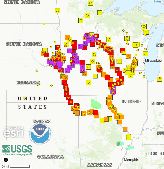
Catastrophic rain in the NW corn belt has the Missouri River and Upper Mississippi in full blown flood mode.
24 gauges are currently at major flood levels while 23 are at moderate levels:
The only good thing is floodwater from this system will be dispersed between both the Missouri and (Upper) Mississippi Rivers - avoiding true catastrophic flooding on one or the other.
Not saying we are not seeing very high water, damage and operational interruptions - but we are lucky it is making its way to the US Gulf via two large rivers vs one.
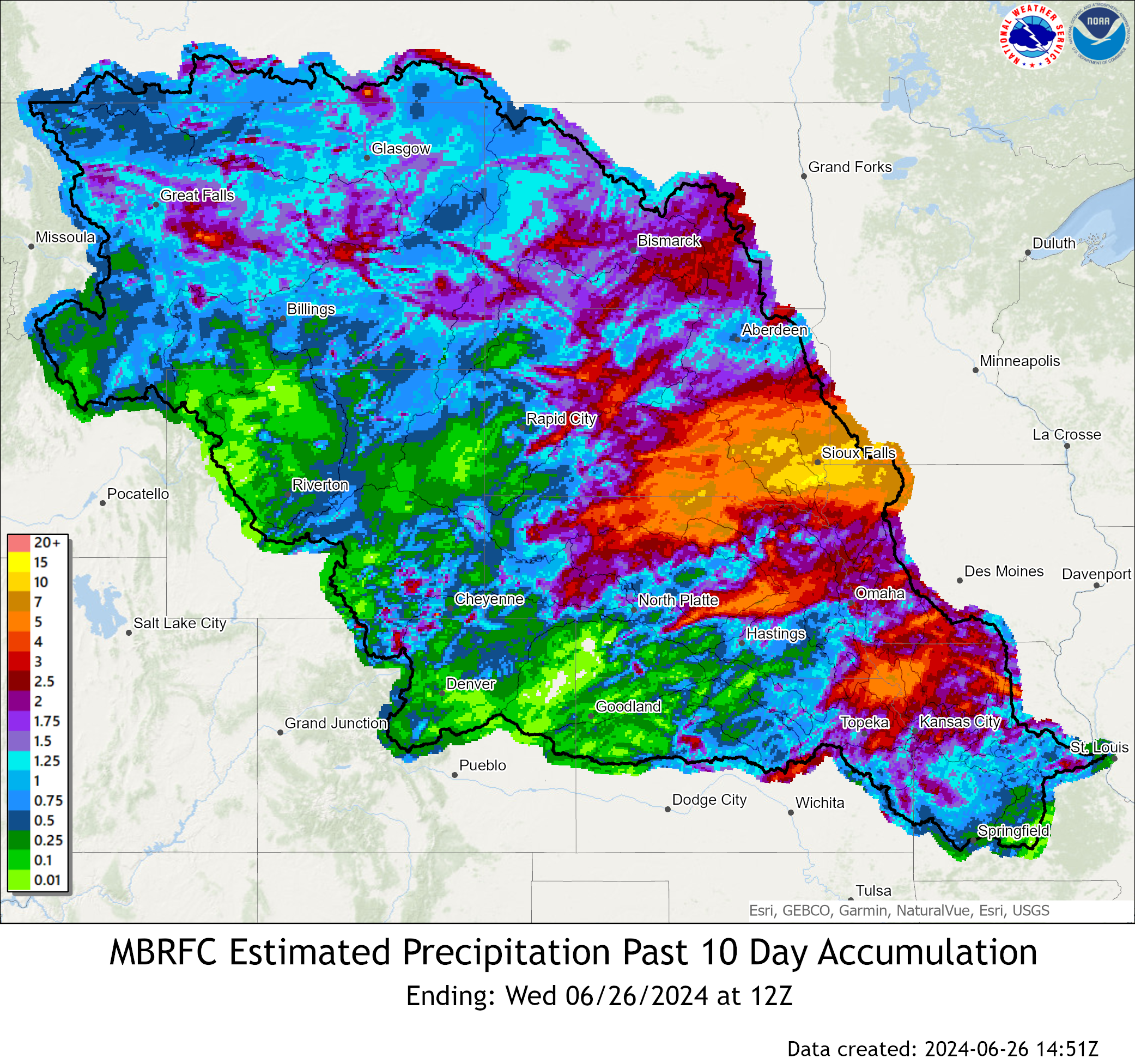
To illustrate my point, this is observed precipitation totals from the last 10 days in the Missouri River basin:
(keep an eye on that far eastern ‘dividing line’)
Keep reading with a 7-day free trial
Subscribe to No Bull to keep reading this post and get 7 days of free access to the full post archives.