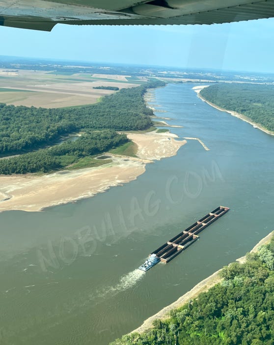
Today I decided to take a field trip…. viewing fields from above and the once-Mighty Mississippi as low water continues to snarl river logistics.
For starters - this is not my first rodeo in a small plane.
My dad had a Cessna 172 Skyhawk and we went EVERYWHERE in it.
Here we are circa 1992 watching the Blue Angels at an air show. Look at this quality bonding going on:
I am not sure what is worse in this pic - the haircut, my scraped up legs, the purple socks or those shoes.
Back to 2023 - my pilot today was long-time family friend Larry who also just so happened to be the one driving the boat when I broke my nose waterskiing at the ripe old age of 10.
Larry was helping me learn to slalom ski - by kicking one off.
Unfortunately for me (and my nose) one kick somehow resulted in a ski to the face which subsequently broke my nose and left me with a bright white nose cast for 5th grade pictures.
Horrible, horrible!
Today, conditions up and down the Mississippi River are just as horrible.
That is why I commissioned Larry for a three hour tour heading down the Mississippi, to the confluence with the Ohio and further south near Tiptonville, TN where the real problems arise.
From the Illinois side of the Mississippi, looking north you can see several exposed dikes along the Missouri side of the river (those are the Ste. Genevieve bottoms off to the left).
THIS IS NOT NORMAL.
You will soon realize this is a recurring theme up and down the ‘largest’ river in the United States.
Same goes for this spot south of Chester, IL - numerous dikes and chevrons left out in the open… many of which had a healthy crop of grass and weeds growing on top.
Chevron dikes are placed in the shallow side of the river channel (in this case, on the Missouri side of the river across from Rockwood, IL) pointing upstream, aiding in channel development.
Keep reading with a 7-day free trial
Subscribe to No Bull to keep reading this post and get 7 days of free access to the full post archives.


